|
| |
|
| |
Forum Perangkat GPS: Indonesia GPS |
| |
|
|
| |
|
| Topik | : Indonesia GPS |
| Penulis |
:  QmQ QmQ |
(GMT) 21:59:44 Jumat, 18 Juli 2008
|
| Tanggapan |
: 73 |
Dilihat: 20660
|
Kategori : Perangkat GPS
|
|
Welcome everybody,
Please forgive me writing in English but I come from far away and cannot speak your language. I hope this is not a problem.
I've registered at this site because it seems to be connected with the topic of GPS navigation. I must say registering was fun - no idea what the confirmation email means 
Anyhow, I need your help. I'm going to visit Indonesia quite soon and I'd like to take my GPS navigation with me. It will probably be very useful. However the software I'm using does not have any map of this region. I've searched a bit and it seems that the only reasonable solution is to use one of your local GPS programs. Could anyone tell me where I can one of those? Or possibly just a name so I can search for it.
Or maybe you use one of the international ones that have maps of more than one country - if so please tell me the name of the program. The only program I've found is from Garmin but I cannot find any details of the supported region...
Actually, anything will be helpful - I'm quite stuck.
I also apologize if this is not the correct category - I don't know what 'perangkat' means :P
If it's important - I will be traveling to Jakarta and later to Semarang. So I'm looking for maps of Java and possibly the neighbor islands as well.
Thank you very much for help and once again, sorry for writing in English.
Best regards,
QmQ
|
|
|
|
| |
Halaman :
 1 2 3 4 1 2 3 4 |
| |
| Tanggapan |
|
bsuroyo,
(GMT) 01:28:38 Jumat, 08 Agustus 2008)
| |
No need to say sorry pak Mbon, as you've done nothing wrong here... ;-)
Tracklog and playback function on Nuvi 200 firmware 3.40 is actually a hidden feature (accidentally leaked out of the cage as it was only intended for engineering/test purposes), and was removed from its subsequent firmware release by Garmin. Therefore, there was NO support and you got it as it is - and it might be difficult to find answer/solution to problem(s) related with it.
|
|
mbon,
(GMT) 10:47:08 Jumat, 08 Agustus 2008)
| |
Hi pak bsuroyo,
I was saying sorry because I thought that I might flood the forum with my useless post T_T anyway, thankyou for the reply.. well if that's the case, then it might be a bad luck for me T_T well, since I bought it second hand... anyway, is there any way to hard reset / reformat the nuvi 200 back ? who knows it could solve the problem =)
|
|
bsuroyo,
(GMT) 10:45:14 Rabu, 20 Agustus 2008)
| |
To pak Trek: just would like to update that I've had a chance to test your Bandung Oziexplorer map last weekend (based on your scanned Periplus map). It's scanned quality is great, and the calibration is excellent! Am running it side by side on my Ipaq PDA and my Nuvi in the car, and it's really interesting to see raster and vector maps work and complement each other together...
Again, thanks a lot pak!
|
|
trek,
(GMT) 15:02:40 Kamis, 21 Agustus 2008)
| |
Pak Bambang, you can call me Budi. 'Pak trek' just sounds really weird. No pun intended (trek-budi), really.. 
It's good to know you like it, thank you The scan quality is alright I guess. It was scanned using my new scanner that I bought earlier this year, much better than my ancient, no good, el cheapo scanner that was used for scanning the surabaya map. Also, wrong choice of image processing tools and low dpi scanning exacerbate the picture quality of the surabaya map even further.
The calibration is also ok I suppose, thanks to the good quality of the map, the excellent accuracy of the reference map (garmin cn in this case), and ozi. All I did was stitching the pages, determined four or more calibration points, and that's all. I think that many people could do it if they want to.
Actually you don't have to be in Bandung to see the accuracy of the map. Just load your tracklogs into ozi and you could see it right away. If you don't have one, it's easy to create it yourself by converting route you draw in MapSource, save it as gdb v2, convert it to gdb track using winGDB, and finally convert the gdb track to gpx using gpsbabel.
Good on you for having multiple gps gadgets like those pak Bambang. It seems that one can never have enough gps devices these days..  I own three bt gpsr myself (all Holux) and I might get a stand alone PND someday. The funny thing about the booming gps market nowadays is that the shares of those gps companies are going to the opposite direction, sinking like a rock. Sirf Tech is heading into oblivion while Garmin and TomTom (TeleAtlas parent company) are hovering just above their 52 week low. Take a look at the charts below: I own three bt gpsr myself (all Holux) and I might get a stand alone PND someday. The funny thing about the booming gps market nowadays is that the shares of those gps companies are going to the opposite direction, sinking like a rock. Sirf Tech is heading into oblivion while Garmin and TomTom (TeleAtlas parent company) are hovering just above their 52 week low. Take a look at the charts below:
http://finance.yahoo.com/q/bc?s=GRMN&t=my&l=off&z=l&q=l&c=
http://finance.yahoo.com/q/bc?s=SIRF&t=5y&l=off&z=l&q=l&c=
Just a little information that I thought you guys might interested in knowing. OK, off topic no more
|
|
bsuroyo,
(GMT) 03:08:07 Jumat, 22 Agustus 2008)
| |
Hi pak Budi: It might be a bit easy to understand w/ SIRF case, as a lot of their competitors built new GPS chipsets rivaling their famous SiRF-III in sensitivity and accuracy (notably MediaTek and Garmin's own chipset). Moreover, a lot of companies built the GPS functionality into cellphone chipsets (Qualcomm, Nokia, to name a few) and predicted to steal some of GPS market share away.
For Garmin, I am a bit surprise as currently they hold at least 50% of the market share (based on 2007 report). But it is true that the most growing GPS market is the consumer/entry level PND GPS, and it is a fierce competitive playing field there (means small/least profit).
Garmin used to be a major GPS supplier to military, or producing premium GPS unit (w/ high profit ;-)
Just a couple of years ago, Garmin GPS unit price used to be very high - and it still keeps falling even now. I've read interesting article in GPSMagazine, explaining why Garmin have to enter cellphone market w/ its upcoming Nuviphone. Garmin has to change their business line in order to survive and prosper...
http://www.gpsmagazine.com/2008/06/why_garmins_nuvifone_could_be.php
Enough of this off-topic discussion then... ;-)
|
|
QmQ,
(GMT) 10:07:37 Senin, 25 Agustus 2008)
| |
So, here I am having some free time
I've come up with this:
http://navigasi.net/goptd.php
Is that the map we've been talking about here?
|
|
bsuroyo,
(GMT) 01:00:35 Kamis, 28 Agustus 2008)
| |
Hi QmQ, that's correct. You can download the major update of Navigasi.net map with the name of gmapsupp.img file there for free (v52, released on 17 August).
There should be another update coming in on 17 Sept.
|
|
QmQ,
(GMT) 12:42:21 Kamis, 28 Agustus 2008)
| |
That's fantastic
Thank you for the work and time spent on the map.
|
|
teknosurvey,
(GMT) 07:27:48 Senin, 13 April 2015)
| |
Jual Kompas Geologi DQL8 Hub.08176755161
Negara Asal: China
Precision of long air level: 15 ( + / -3) / 2mm
Precision of circle air level: 30( + / -5) / 2mm
The reading error d0. 5 centi grade
Dial scale: 1centi grade
Weight: 0. 27kg
Size: 80x70x35( mm)
CV. TEKNO SURVEY
Jl. Kesehatan Raya No.29
Bintaro Sektor 1 - jakarta Selatan
Contact Person :
Ambar
Hp. 0812 8985 4242 / 0817 6755 161
Tlp. 021-8394 3215
PIN BB 25CC29C5
|
|
teknosurvey,
(GMT) 07:33:01 Senin, 13 April 2015)
| |
Gpsmap Garmin Fishfinder 585 With Bluechart
Negara Asal: Taiwan
he GPSMAP 585 adalah full-fungsi bagan plotter bahwa fitur ultra-terang 5 " warna layar WQVGA bersama dengan fitur peningkatan kecepatan tinggi menggambar peta dan panning. Ini ' s siap untuk pergi dengan antarmuka yang mudah untuk digunakan dan basemap built-in di seluruh dunia. The 585 adalah komplotan grafik unik Garmin yang tidak hanya membekali dengan bahasa Inggris, tetapi juga dengan bahasa-bahasa Asia, termasuk Cina Sederhana dan Bahasa Indonesia. GPSMAP 585 dirancang khusus untuk nelayan profesional dan dilengkapi dengan keunggulan Garmin ' s terkenal GPS168 / 178C komplotan grafik. Terlebih lagi, kini Anda dapat ikan dengan plotter grafik berkualitas tinggi dengan biaya lebih terjangkau.
Jelajahi Laut
The GPSMAP 585 datang standar dengan modul built-in high-sensitivity GPS untuk pelacakan satelit unggul dan akuisisi kali lebih cepat. Dan dengan slot kartu SD, sangat mudah untuk menambahkan peta tambahan tanpa terhubung ke komputer.
Tambahkan Sonar
Mana yang berlaku, versi sounder, GPSMAP 585, dilengkapi dengan transduser opsional yang dengan jelas dapat menggambarkan kontur kedalaman, target ikan dan struktur. Apakah kembali memancing Anda berada di air tawar atau di lepas pantai, Anda selalu dapat menemukan transduser Garmin yang tepat dari berbagai jenis sesuai dengan kebutuhan anda. GPSMAP 585 juga NMEA 0183 kompatibel untuk konektivitas dengan sensor, instrumen dan penawaran kelautan masa depan.
The GPSMAP 585 adalah full-fungsi bagan plotter bahwa fitur ultra-terang 5 " warna layar WQVGA bersama dengan fitur peningkatan kecepatan tinggi menggambar peta dan panning. Ini ' s siap untuk pergi dengan antarmuka yang mudah untuk digunakan dan basemap built-in di seluruh dunia. The 585 adalah komplotan grafik unik Garmin yang tidak hanya membekali dengan bahasa Inggris, tetapi juga dengan bahasa-bahasa Asia, termasuk Cina Sederhana dan Bahasa Indonesia. GPSMAP 585 dirancang khusus untuk nelayan profesional dan dilengkapi dengan keunggulan Garmin ' s terkenal GPS168 / 178C komplotan grafik. Terlebih lagi, kini Anda dapat ikan dengan plotter grafik berkualitas tinggi dengan biaya lebih terjangkau.
Jelajahi Laut
The GPSMAP 585 datang standar dengan modul built-in high-sensitivity GPS untuk pelacakan satelit unggul dan akuisisi kali lebih cepat. Dan dengan slot kartu SD, sangat mudah untuk menambahkan peta tambahan tanpa terhubung ke komputer.
Tambahkan Sonar
Mana yang berlaku, versi sounder, GPSMAP 585, dilengkapi dengan transduser opsional yang dengan jelas dapat menggambarkan kontur kedalaman, target ikan dan struktur. Apakah kembali memancing Anda berada di air tawar atau di lepas pantai, Anda selalu dapat menemukan transduser Garmin yang tepat dari berbagai jenis sesuai dengan kebutuhan anda. GPSMAP 585 juga NMEA 0183 kompatibel untuk konektivitas dengan sensor, instrumen dan penawaran kelautan masa depan.
CV. TEKNO SURVEY
Jl. Kesehatan Raya No.29
Bintaro Sektor 1 - jakarta Selatan
Contact Person :
Ambar
Hp. 0812 8985 4242 / 0817 6755 161
Tlp. 021-8394 3215
PIN BB 25CC29C5
|
|
teknosurvey,
(GMT) 07:36:34 Senin, 13 April 2015)
| |
Dendrometer Criterion RD1000
Negara Asal: Taiwan
you may have to use basal area for variable plot cruising and determine if questionable \" borderline \" trees are in or out of the plot. You may also have to measure a tree diameter anywhere on the stem and verify the height at which specific diameters occur. This is all easier said than done considering the available tools and technology you are most likely used to.
Criterion RD 1000 Video
If you have worked in the forest before, you don\' t need to be reminded how hard it can be to position yourself in just the right spot for your equipment to work properly. Let\' s then take away decent lighting conditions so you can struggle to take those black markings found with your equipment\' s scope, and align them with a dark colored tree.
This is precisely why Laser Technology developed the Criterion RD 1000 - the first-of-its-kind measurement tool designed with forestry professionals in mind.
Imagine the flexibility you would have if your measurement lines were adjustable, so you no longer had to be at a set distance away from a tree. This functionality alone will make your life easier because you choose where to stand, not your equipment. You can even decide if the row of LEDs in the sighting scope are a \" solid bar \" or as a \" gap bar, \" depending upon your circumstance.
It is now possible for you to adjust the level of brightness so you can actually see your measurement bar scales in all kinds of lighting conditions. Your production will vastly increase because you will no longer have downtime due to the circumstances of your surroundings.
Direct diameter
measurement
What about the luxury of having a direct read-out of your measurements? Even though you may be used to referring to complicated charts for calculations, imagine how nice it would be to get a direct read-out of slope, heights and diameters displayed right in the eyepiece, which will update continuously as you adjust the controls.
By integrating a tilt sensor within the Criterion RD 1000, you can use it as a dendrometer and measure diameters anywhere on the stem as well as the height at which a specific diameter occurs. It can also be used as a slope-corrected Basal Area scope for variable plot cruising. Obtain diameter accuracy of + / - 0.25 inch out to 80 feet away from the tree by utilizing the included detachable magnifying lens.
Accurate, lightweight, multifunctional, dependable and relatively inexpensive best describes the Criterion RD 1000. Are you ready to start measuring more, while moving less?
How the Criterion RD 1000 Measures Up:
Measure the diameter of tree stems or limbs as well as the heights at which a specified diameter occurs.
View the percent slope grade of a plot and determine whether a tree is \" In \" or \" Out \" of your sample.
Shift the illuminated measurement scales instead of positioning yourself at a distance.
Displays direct read-outs of measurements on the in-scope LED.
Adjust the brightness levels seen inside the scope.
Use as a slope-corrected BAF-scope for variable plot cruising.
Quickly determine the limiting distance for \" borderline \" trees.
Enjoy seamless integration with all LTI\' s laser rangefinders and compatible software.
CV. TEKNO SURVEY
Jl. Kesehatan Raya No.29
Bintaro Sektor 1 - jakarta Selatan
Contact Person :
Ambar
Hp. 0812 8985 4242 / 0817 6755 161
Tlp. 021-8394 3215
PIN BB 25CC29C5
|
|
teknosurvey,
(GMT) 07:39:54 Senin, 13 April 2015)
| |
GPS Trimble Juno 3B
Negara Asal: Amerika Serikat
Trusted data collection whenever you need it
Harness the strength of your distributed team to provide geo-enabled data you can trust. With the Trimble® Juno® series, your mobile workforce is empowered with a fully integrated, GPS-based data collection system for everyday field work. If your organization is managing critical assets, responding to emergencies or keeping an enterprise GIS current, you can increase efficiency— both in the field and in the office with dedicated data collection workflows and Trimble Juno handhelds.
Delivered in a compact package resistant to dust, water, and shock, the Trimble Juno provides a complete, integrated package of positioning, imaging and communications for total flexibility day after day.
Choose either the Juno 3B or 3D model to suit your needs:
Product Models Juno 3B Juno 3D
Cellular voice & data No Yes
Integrated camera 5 MP 5 MP with Flash
Microsoft Office Mobile No Yes
KEY FEATURES
Rugged IP54 rating for tough outdoor conditions
Feature packed, fully integrated, affordable
3.75G cellular data and voice capability
High-sensitivity GPS receiver
5 megapixel autofocus camera with flash
Long life battery for all-day use
Lightweight and compact
GPS
* High-sensitivity GPS/ SBAS1 receiver and antenna
Standard Software
* Adobe Reader
Standard Accessories
* USB data cable
* Stylus with lanyard
* Wrist lanyard
* Rechargeable Li-ion battery
* International AC power supply
CV. TEKNO SURVEY
Jl. Kesehatan Raya No.29
Bintaro Sektor 1 - jakarta Selatan
Contact Person :
Ambar
Hp. 0812 8985 4242 / 0817 6755 161
Tlp. 021-8394 3215
PIN BB 25CC29C5
|
|
teknosurvey,
(GMT) 07:46:58 Senin, 13 April 2015)
| |
GPS Garmin Zumo 390
Negara Asal: Taiwan
Physical & Performance
Unit dimensions, WxHxD 5.12 " W x 3.7 " H x 1.18 " D ( 13.0 x 9.4 x 3.0 cm)
Display size, WxH 3.7 " W x 2.2 " H ( 9.4 x 5.6 cm) ; 4.3 " diag ( 10.9 cm)
Display resolution, WxH 480 x 272 pixels, 480 x 272 pixels
Display type WQVGA color TFT with white backlight
Weight 9.5 ounces ( 270 g)
Battery rechargeable lithium-ion
Battery life up to 7 hours, up to 7 hours
Headphone jack/ audio line-out Yes
High-sensitivity receiver Yes
Waterproof Yes ( IPX7)
Maps & Memory
Preloaded street maps Yes
Includes lifetime map updates Yes
nü Maps Guarantee yes
3-D terrain view No
3-D buildings and landmarks view No
Built-in memory internal solid state
Accepts data cards microSDâ„¢ card ( not included)
Waypoints/ favorites/ locations 1000
Features & Benefits
Features That Save Time & Money
Voice prompts ( e.g. " Turn right in 500 ft. " ) Yes ( Internal speaker)
Speaks street names ( e.g. " Turn right ON ELM STREET in 500 ft. " ) Yes
Voice-activated navigation ( operate device with spoken commands) No
Traffic compatible ( routes around traffic with a receiver and subscription) Yes ( in automotive mount)
Lifetime traffic updates ( receive free lifetime traffic updates) No
Lane assist ( guides to proper lane for navigation) Yes
Junction view ( displays junction signs) Yes
myTrendsâ„¢ ( predicts your routes) No
trafficTrendsâ„¢ ( calculates routes based on predicted traffic flow) Yes
Auto sort multiple destinations ( provides most direct route) Yes
Route avoidance ( avoid highways, tolls etc.) Yes
XM® compatible for U.S No
Safe Navigation Features
Bluetooth® wireless technology Yes
Speed limit indicator ( displays speed limit for most major roads in the U.S. and Europe) Yes
Where Am I? ( find closest hospitals, police & gas stations, nearest address & intersection) Yes
Enhanced pedestrian navigation ( guides you as you walk around town) no
Photo navigation ( navigate to geotagged photos) No
View upcoming points of interest along route Yes
Custom POIs ( ability to add additional points of interest) Yes
Garmin Lockâ„¢ ( anti-theft feature) No
Customizable Features
Garmin Garageâ„¢ vehicles compatible ( download car-shaped icons to your device) Yes
Garmin Garageâ„¢ voices compatible ( download custom voices to your device) Yes
MP3 player No
Audio book player No
Additional Specs
Trip Planner: yes
Trip Log: yes
Tire pressure monitor system: yes; individual sensors sold separately
Curvy Roads routing: yes
Power supplied to device power cable should be capable of up 12 V ( typical) and up to 1 A. zkmo device power consumption is 5 V; 2 A.
This USB device is compatible with Windows® XP or newer and Mac® OS X 10.4 or later.
In the box :
zkmo 390
Preloaded City Navigator Indonesia & Navigasi.net
Motorcycle mount with power cable and mounting hardware
Automotive power cable
USB cable
Quick start manual
1 Year warranty
CV. TEKNO SURVEY
Jl. Kesehatan Raya No.29
Bintaro Sektor 1 - jakarta Selatan
Contact Person :
Ambar
Hp. 0812 8985 4242 / 0817 6755 161
Tlp. 021-8394 3215
PIN BB 25CC29C5
|
|
teknosurvey,
(GMT) 07:49:32 Senin, 13 April 2015)
| |
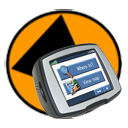
GPS Garmin Etrex 10,20,30
 | |  | | 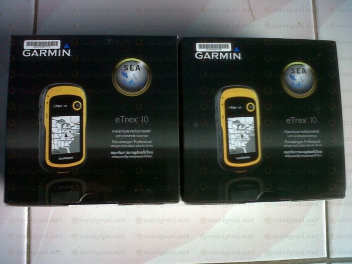 | | |
Negara Asal: Taiwan Etrex 10 merupakan generasi pengganti Etrex H, dengan layar 2.2inc monochrome bisa menampilkan informasi posisi dengan sempurna. Etrex 10 juga sudah menggunakan teknologi hot fix sattelite prediction, sehingga bisa menangkap signal gps dengan cepat dan akurat, Dan yang lebih canggih lagi, Etrex 10 sudah bisa menangkap signal GLONASS, yang merupakan konstelasi satelleite posisi yang dikembangkan oleh Rusia. Glonass akan efektif beroperasi secara sempurna mulai tahun 2012 ini. Dengan adanya Glonass, Etrex 10 akan lebih cepat mendapatkan posisi secara akurat. Etrex10 juga sudah menggunakan usb untuk koneksi data ke komputer, jadi anda tidak perlu repot lagi untuk menyimpan data anda. Physical & Performance: Unit dimensions, WxHxD: 2.1 " x 4.0 " x 1.3 " ( 5.4 x 10.3 x 3.3 cm) Display size, WxH: 1.4 " x 1.7 " ( 3.6 x 4.3 cm) ; 2.2 " diag ( 5.6 cm) Display resolution, WxH: 128 x 160 pixels Display type: transflective, monochrome Weight: 5 oz ( 141.7 g) with batteries Battery: 2 AA batteries ( not included) ; NiMH or Lithium recommended Battery life: 25 hours Waterproof: yes ( IPX7) Floats: no High-sensitivity receiver: yes Interface: USB Maps & Memory: Basemap: yes Preloaded maps: no Ability to add maps: no Built-in memory: no Accepts data cards: no Waypoints/ favorites/ locations: 1000 Routes: 50 Track log: 10, 000 points, 100 saved tracks Features & Benefits: Automatic routing ( turn by turn routing on roads) : no Electronic compass: no Touchscreen: no Barometric altimeter: no Camera: no Geocaching-friendly: yes ( paperless) Custom maps compatible: no Photo navigation ( navigate to geotagged photos) : no Outdoor GPS games: no Hunt/ fish calendar: yes Sun and moon information: yes Tide tables: yes Area calculation: yes Custom POIs ( ability to add additional points of interest) : yes Unit-to-unit transfer ( shares data wirelessly with similar units) : no Picture viewer: no Garmin Connectâ„¢ compatible ( online community where you analyze, categorize and share data) : yes What' s in the Box: eTrex 10 USB cable Manual 1 Year warranty CV. TEKNO SURVEY Jl. Kesehatan Raya No.29 Bintaro Sektor 1 - jakarta Selatan Contact Person : Ambar Hp. 0812 8985 4242 / 0817 6755 161 Tlp. 021-8394 3215 PIN BB 25CC29C5 | |  | |  |
|
Anda diharuskan login terlebih dahulu sebelum memberi tanggapan. terlebih dahulu sebelum memberi tanggapan. |
|